Anax
Anax is a global-scale federated and widely-distributed mapping infrastructure. Here, we provide the documentation and links to some tools built for Anax. The map server with image-based localization implementation will be open-sourced after publication. This site is hosted anonymously for peer review.
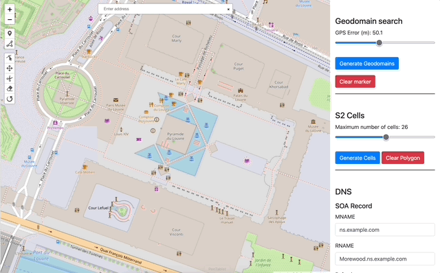
Geo-domain Explorer
Geo-domain Explorer tool visualizes the geo-domains that are queried by an Anax device for a given location and search radius. It also automates the creation of DNS records needed to register a map server to make it discoverable by Anax. See Geo-domain explorer section for documentation.
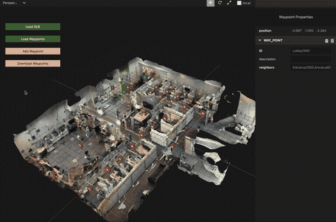
3D map creator
Waypoint Tagger tool helps map creators visualize their 3D map and tag map nodes and ways on it. The creators can also export their map to be used with the map server. See Waypoint Tagger section for documentation.
Map server
We provide a reference implementation of a map server that works with Anax. We will open-source the implementation after publication, but here we provide a preview of its functionalities. The server provides services such as map creation, localization, and routing. We also provide an augmented reality application that displays the tagged waypoints against the real-world using the Visual Positioning System (VPS). See Map Server section for documentation on how to create and localize against maps.